Sahastra Tal Trek
9D – 8N | Dehradun to Dehradun
Enquire for Group Booking
↬ Description
- Altitude : 15100 ft.
- Duration: 9 Days
- Trek Length: 75 kms
- Base Camp: Bhatwari
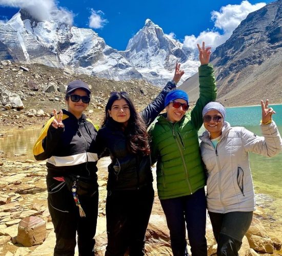
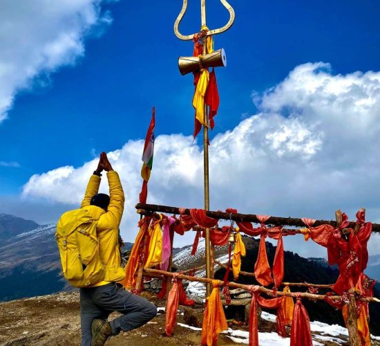
The walk to Sahastra Tal lake is also often referred to as “the lake of the gods” and the seven lake trek. The district of Uttarkashi in the state of Uttarakhand is where you’ll find it. The walk is encircled on all sides by breathtaking valleys: to the west is the Bhagirathi Valley, and to the east is the Bhilangana Valley. Both of these valleys may be found on the Indian subcontinent. The Kush Kalyan Plateau is a high ridge that can be found to the north of this lake. It is flanked on each side by a number of other smaller lakes of varying sizes. On the highest point of this hill is where you’ll find the lake. Locals place a high level of importance on the lake’s spiritual significance; as a result, they perform an annual rite in which they carry their god on their shoulders while walking around the lake. The locals also tell a story about this lake that involves a monarch who, after completing a rite in the lake, presented one thousand sahastra flowers to Lord Vishnu as an offering. This story is connected to the lake. Trekking in Uttarakhand is a must go for any enthusiast trekker because this trek offers you a view of the beautiful green meadows, wild fauna, and flora along with the chance to view some great peaks like Jaonli, Srikanth, and other high Himalayan ranges. This trek is a must go for any enthusiast trekker because it offers you a view of the beautiful green meadows, wild fauna, and flora. This location is often deserted and does not see a high volume of foot traffic from visitors or hikers.
↬ Itinerary
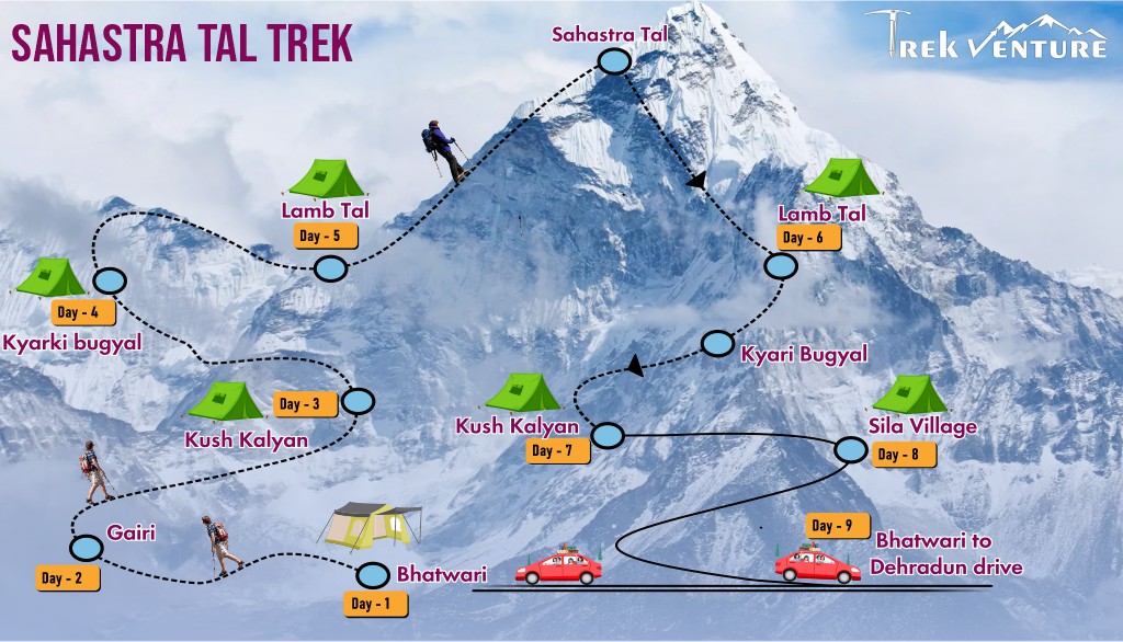
Day 1: From Dehradun to Bhatwari drive
The first part of our first day will be spent travelling by car from Haridwar to Bhatwari, which is situated at an elevation of 5000 feet. We are going to drive a total of 220 km, and it is estimated that it will take us around 10 hours to reach our goal. We will go via Rishikesh, Chamba, and Dharasu on the way to our destination. Bhatwari also serves as the district tehsil’s administrative centre. The Bhagirathi Canal will be our route as we go north. After reaching our destination, we will check into a lodge for the night and spend the night there.
Day 2: Trek from Bhatwari to Gairi
Along the path that leads from Uttarkashi to Gangotri, our walk will start with a descent of approximately half an hour from Bhatwari to Malla. A little hamlet known as Malla may be found on both the left and right banks of the Bhagirathi River. After we cross the bridge over the river, we will finally arrive in Silla, the very last village. After traversing the settlement, we will continue our ascent by following a trail that winds through the evergreen mountain forest. After a walk of four to five hours, we will reach Gairi, which is the only location beyond Silla that has water and serves as a cow pasture for local farmers during the monsoon and summer months. This is where we will be sleeping for the night.
Read MoreDay 3: From Gairi to Kush Kalyan Trek
The first part of our journey will consist of ascending for an hour through the forest until we reach an opening that is populated with covered hut-like buildings that provide a breathtaking perspective of the northern region. After we go through this opening, we will be able to enter the oak woods. The going is going to become tougher from this point on. We will have to climb for a total of three hours in order to reach the Chuli La pass. After travelling over the mountain, the route continues to be challenging as it makes its way down into the meadows. It is important to take note that after we reach the Kush Kalyan Plateau, there is no source of water for a considerable distance. Our camping area is conveniently located near the Kush Kalyan mountain. The overall distance covered during this day’s walk is 12 km, which may be finished in less than six hours.
Day 4: From Kush Kalyan Trek to Kyarki bugyal
On our fourth day of hiking, as we continue to climb higher, the amount of tree cover will decrease, and the meadows will become more visible. We have a little period of downhill before beginning the ascent to Bhowani Bugyal, which is slightly over an hour away from our final destination. After traversing the pass, we will go downhill in order to get to our camping area. In the range of 6-7 hours, we will go a distance of around 12 km. In order to obtain some much-needed rest before our arrival in the morning, we will turn in for the night.
Day 5: From Kyarki Bugyal to Lamb Tal Trekking
The trip that we take today will not be too long. We are going to make our way up to a path that is located above the Kyarki campground. Snow will start to fall at this location in June. During the monsoon, this region will be covered with flowers, namely Brahma kamal and Fen kamal. After going past this mountain, we approach another ridge that first has multiple bends, but subsequently expands to create a track known as “chhe Phuti Road,” which literally translates to “six-foot-wide path,” and was constructed during the time of the British. After a period of time, a number of smaller and medium-sized lakes, such as Kokuli Tal and Lamb Tal, will start to form. It takes around four to five hours to cover the approximately six km distance that is entire. Now that we have reached there, it is time to relax.
Day 6: From Lamb Tal trek to Sahastra Tal and return
On this day, we will make an effort to climb Sahastra Tal, which is rated as being somewhat challenging. To begin, we are going to make our way up to the crest using a zigzag pattern. The ascent will start out quite simple, but it will gradually get more difficult as it continues. The fact that there will be snow in the fall makes hiking a far more challenging and time-consuming endeavour. The mountain is called Kokuli Dhar, and the panorama that can be seen from the peak is quite stunning. The ascent to the ridge shouldn’t take more than an hour, and from this vantage point, we should be able to view the Sahastra peak. However, the visibility may be impaired if the summit is shrouded in cloud cover. We leave this location and make our way to Dhoni Tal, a pool of average size. After that, we climb the steep road that leads to Sahastra Tal, a large lake with waters that are completely transparent. After wandering about for an hour or two, we are going to return to our respective camps. We will walk a total of 12 km, which may take between 7-8 hours to complete.
Day 7: From Lamb Tal to Kush Kalyan Trekking via Kyari Bugyal
It is estimated that it will take us between 7-8 hours to finish the journey, which will cover a total distance of 28 km. After making our way back down from Kyari Bugyal to Kyari Khal, we will continue on to Kush Kalyan, which is our ultimate goal.
Day 8: From Kush Kalyan to Sila Village
We begin our descent through lush meadows, leading into dense coniferous forests. Along the way, we pass through the picturesque village of Pinswar. The trek covers a distance of approximately 10 kilometers, taking around 5-6 hours to reach the pickup point for our vehicle. From here, we embark on a 3-4 hour drive to Ghansali. Due to its lower elevation, Ghansali can feel quite congested. We expect to arrive by evening, where we will settle into our lodge for an overnight stay.
Day 9: From Sira to Bhatwari to Dehradun
We will make our way back to Dehradun, where our journey began. The distance is approximately 150 kilometers, with an estimated travel time of 8 hours.
↬ Map of Sahastra Tal Trek

↬ Inclusion
- From Day 1 through Day 9 of your walk, you will be sleeping in various hotels and tents.
- All meals are provided, beginning with the first night’s dinner and ending with breakfast on day nine. On all days of the walk, we provide simple, healthy vegetarian meals.
- We will provide for round-trip transportation from Dehradun to Dehradun
- Trekking permits and camping expenses in the woods are all accounted for.
- Tents and sleeping bags of the highest quality will be provided at each camp. Fortunately, we have high-altitude sleeping bags that are good down to ten degrees Celsius.
- Gaiters, microspikes, and ropes are available.
↬ Exclusion
- Costs associated with carrying personal items, such as luggage, on the hike.
- The term “emergency costs” refers to any and all costs that crop up as a direct consequence of a crisis.
- There will be no access to bottled water at any point throughout the walk.
- Cost of transportation from Dehradun to Bhatwari (between 1000 and 1500 INR)


